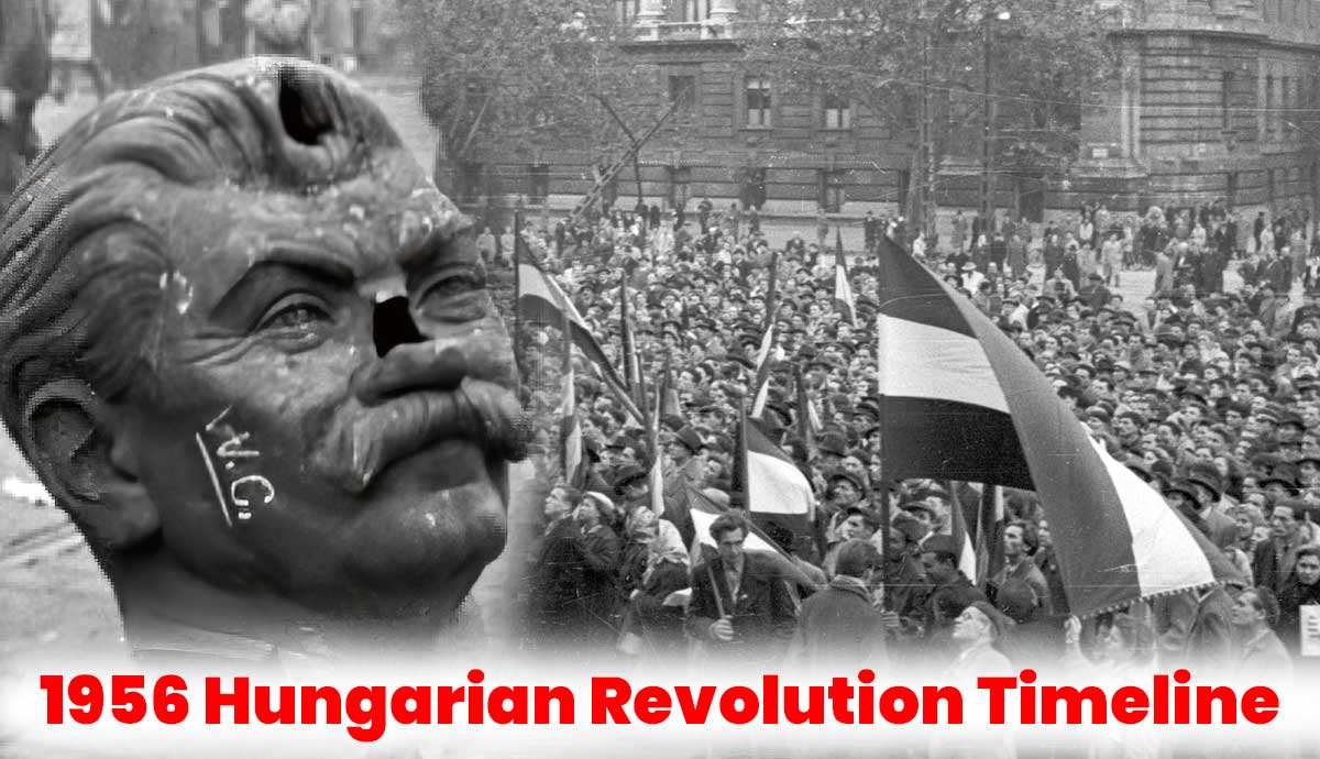
PFP Test - History
Neueste Updates
  • WWW.THEHISTORYBLOG.COM
    Large Bronze Age metal hoard found in Saxony
    A Bronze Age hoard comprising 35 pounds of bronze in 310 objects has been discovered in the Klein Neundorf suburb of Grlitz in eastern Germany. Dating to the 9th century B.C., it is the largest Bronze Age hoard ever found in Upper Lusatia and the second-largest in all of Saxony.Bronze Age objects had been found at the site since 1900, when children harvesting potatoes stumbled on three bronze daggers. One of them was lost soon after the discovery; the two remaining ones were acquired by the Grlitz Museum in 1905. One of the surviving pair was lost in the chaos of World War II, so of the original three daggers, only one remains. The childrens father donated a socketed axe to the museum two years later.The objects had been in the museum collection for more than a century when Dr. Jasper von Richthofen, the director of the Grlitz Collections, hatched a plan to excavate the find site for the first time in August of 2023, with the collaboration of the Saxon State Office for Archaeology and volunteer metal detectorists. It was one of the metal detectorists who made the initial breakthrough, finding bronze sickle fragments on the western edge of the exploration area. The rest of the team joined in and more objects were discovered in the plow zone. In total, 108 objects from the hoard were discovered that had been scattered by plowing activity.Finally, several objects were found clustered together in one place. They were the surface of the original deposition, what was left in place when the artifacts at the top were scattered by plows. The rest of the hoard was still intact in its burial site and was removed in a soil block for excavation in the restoration laboratory of the Saxon State Office for Archaeology.Excavation took place from September 2023 through the end of April 2024. The objects in the hoard include tools, weapons, jewelry, garment fittings and raw metal ingots known as cast cakes. The most of any single object found thus far is sickles; there are 136 sickles in the hoard. The runner-up is axes. There are 50 of them. Photogrammetric pictures were taken at every stage of the excavation so that a 3D model of the hoard could be created that will allow researchers to study artifacts in their original positions and relative to each other.Special features include a sword broken into four pieces and a brooch of the Spindlersfeld type, named after a site near Berlin. Of the four fractures in the sword, two are demonstrably old, indicating that the weapon was deposited in a broken state. When put together, the sword has a total length of 44 cm, making it strikingly short. The pommel consisted of two sheet metal shells between which a disc of organic material, possibly bone or ivory, was attached. Further analyses will shed light on this. Although the sword is typologically unique, experts suspect that it originates from southern Germany.All of the artifacts are now being scientifically analyzed and conserved for future exhibition.
    0 Kommentare 0 Geteilt 1 Ansichten
  • WWW.ONTHISDAY.COM
    Today in History for 27th August 2025
    Historical Events1828 - Uruguay gains independence during Brazil-Argentina peace talks1917 - Indians set club record by stealing eight bases in a game1942 - Soviet woman sniper Lyudmila Pavlichenko arrives in Washington D.C., the first Soviet citizen welcomed at the White House by Eleanor Roosevelt1979 - Warrenpoint ambush: 18 British Army soldiers are killed when the Provisional IRA explodes two roadside bombs as a British convoy passes Narrow Water Castle2012 - First interplanetary human voice recording broadcast from Mars Rover CuriosityMore Historical Events Famous Birthdays1630 - Maria van Oosterwijck, Dutch flower painter, born in Nootdorp, Netherlands (d. 1693)1669 - Anne Marie of Orlans, Queen of Italy, born in Chteau de Saint-Cloud, France (d. 1728)1896 - Leon Theremin, Russian-Soviet electronic musical instruments inventor, born in St. Petersburg, Russia (d. 1993)1941 - Harrison Page, American character actor (Sledge Hammer!; C.P.O. Sharkey), born in Atlanta, Georgia1971 - Julian Cheung Chi-Lam, singer (A Modern Love Story) and actor (Return Of The Cuckoo), born in North Point, British Hong KongMore Famous Birthdays Famous Deaths1910 - Clement of Maasdijk, 1st Dutch aircraft death1965 - Le Corbusier [Charles Jeanneret], Swiss French architect, city planner and artist (Urbanisme), dies at 772009 - Virgilio Savona, Italian jazz singer and composer (Quartetto Cetra - "Un bacio a mezzanotte"; "Crapa pelada"), dies of complications from Parkinson's disease at 892020 - Dick Ritger, American ten-pin bowler (Tournament of Champions 1970, 79 runner-up; 20 career PBA Tour titles), dies at 812020 - Lute Olson, American Basketball Hall of Fame coach (Uni of Iowa 1974-83; NCAA Division I Tournament 1997, Uni of Arizona 1983-2008), dies from stroke complications at 85More Famous Deaths
    0 Kommentare 0 Geteilt 1 Ansichten
  • ALLTHATSINTERESTING.COM
    33 Photos Of The Oval Office That Capture The Storied History Of The White House Room
    From the end of World War II to President Richard Nixon's Watergate recordings, the Oval Office has served as a backdrop for countless historic events.The post 33 Photos Of The Oval Office That Capture The Storied History Of The White House Room appeared first on All That's Interesting.
    0 Kommentare 0 Geteilt 4 Ansichten
  • ALLTHATSINTERESTING.COM
    This 40,000-Year-Old Cave Painting Of A Cow Is The Oldest Animal Drawing In History
    Some experts believe that the animal painting and others found in the cave are some of the earliest examples of the formation of human culture itself.The post This 40,000-Year-Old Cave Painting Of A Cow Is The Oldest Animal Drawing In History appeared first on All That's Interesting.
    0 Kommentare 0 Geteilt 19 Ansichten
  • ALLTHATSINTERESTING.COM
    Rangers Patrolling Jungles In Northern Thailand Just Happened Upon An Untouched Cave Filled With 2,000-Year-Old Rock Art
    While out on a routine patrol in Thailand's Phu Khat Wildlife Sanctuary, rangers recently happened upon a mysterious mountain cave known as Ta Kueng that's covered with ancient rock art that predates the region's recorded history.The post Rangers Patrolling Jungles In Northern Thailand Just Happened Upon An Untouched Cave Filled With 2,000-Year-Old Rock Art appeared first on All That's Interesting.
    0 Kommentare 0 Geteilt 19 Ansichten
  • ALLTHATSINTERESTING.COM
    A Fossil Found On The Isle Of Wight Has Just Been Identified As A New Dinosaur Species With A Large Sail On Its Back
    Istiorachis macarthurae likely used its unique sail to attract mates or intimidate other dinosaurs.The post A Fossil Found On The Isle Of Wight Has Just Been Identified As A New Dinosaur Species With A Large Sail On Its Back appeared first on All That's Interesting.
    0 Kommentare 0 Geteilt 19 Ansichten
  • WWW.THECOLLECTOR.COM
    6 Ancient Wonders of the Americas Still Shrouded in Mystery
    Detail of the Hieroglyphic Stairway of Copn, an ancient Maya city in modern-day Honduras. Source: Wikimedia Commons.The American continents boast ancient wonders that continue to captivate experts and enthusiasts alike. These enigmatic sites reveal the ingenuity of civilizations long before the arrival of Europeans. They also raise important questions about belief, power, and survival.These are six of the most extraordinaryand the most mysteriousancient wonders of the Americas.1. The Pyramid of the SunThe Pyramid of the Sun at the archaeological complex of Teotihuacan in Mexico. Source: National Geographic.In the ancient city of Teotihuacan, near modern-day Mexico City, the Pyramid of the Sun towers over the landscape. Built around 200 AD, the pyramid measures over 200 feet tall and nearly 700 feet wide, making it one of the most significant structures in the ancient Americas.Excavations have revealed a hidden tunnel and chamber beneath the pyramid filled with offerings and sacrificial remains. These discoveries suggest it once served as a shrine or royal tomb. The pre-Aztec civilization that built Teotihuacan, as well as the reasons the city was abandoned by the 7th century, remain some of Mesoamericas greatest mysteries.2. The Nazca LinesAerial photograph of the Tree geoglyph of Nazca in Peru. Source: Diego Celso/Wikimedia Commons.Across 200 square miles of Perus arid plains, hundreds of lines and geoglyphs form the enigmatic Nazca Lines. The Nazca culture of ancient Peru etched the images into the earth nearly 2,500 years ago. Animals such as hummingbirds, monkeys, and killer whales appear alongside sprawling spirals and geometric figures.The exact purpose of these massive drawings remains unknown. Leading theories suggest they aligned with astronomical events, marked important sites, or functioned as appeals for rain in the dry climate.3. Cliff PalaceThe Ancestral Puebloan Cliff Palace at Mesa Verde National Park in Colorado. Source: National Park Service.High in the cliffs of Mesa Verde, Colorado,lies Cliff Palace, the largest known dwelling of the Ancestral Puebloan people. Constructed in the 13th century, Cliff Palace comprised 150 rooms and 23 ceremonial kivas, housing a population of approximately 100 people.Just decades after its construction, the cliffside settlement was left empty. While archaeologists dont know for certain, a prolonged drought likely forced the residents relocation.4. TiwanakuThe Kalasasaya Temple at Tiwanaku in Bolivia. Source: Wikimedia Commons.Near Lake Titicaca in Bolivia, at an elevation of more than 12,000 feet above sea level, the city of Tiwanaku flourished during the first millennium AD. Its monumental structures include the Akapana pyramid and the Kalasasaya temple, home to the famous Gate of the Sun.What sets Tiwanaku apart is its extraordinary stonework. Blocks weighing over 100 tons were cut and precisely fitted without the use of mortar. How the indigenous pre-Inca people of Tiwanaku achieved such feats, and why their city ultimately fell into decline, both remain a mystery.5. CahokiaCahokia Mounds World Heritage Site. Source: Wikimedia Commons.Almost a thousand years ago, the city of Cahokia thrived across the river from modern-day St. Louis, Missouri. Cahokia was the most significant urban settlement of the Native American Mississipian culture, boasting a population that rivaled that of medieval London.Cahokias 120 earthen mounds, including the 14-acre Monks Mound, functioned as ceremonial and political centers. The Cahokian Mounds are considered the largest pre-Columbian earthen construction in the Americas north of Mexico.While no written records survive from the original inhabitants of Cahokia, archaeologists have uncovered a solar calendar and evidence of human sacrifice on the site. By the 14th century, the city was abandoned. Its reasons for collapse remain unclear.6. CopnCopns Hieroglyphic Stairway. Source: Wikimedia Commons.In western Honduras, the ancient Maya city of Copn was ruled by a line of kings beginning in the 5th century. Copn stood out for its achievements in sculpture, including richly decorated temples and plazas. Most famous is the citys aptly-named Hieroglyphic Stairway. With over 2,000 glyphs charting the citys history, it is the longest known Maya inscription.By the 9th century, the once-flourishing city had fallen into decline, possibly due to factors such as environmental degradation, overpopulation, and political instability.
    0 Kommentare 0 Geteilt 19 Ansichten
  • WWW.THECOLLECTOR.COM
    Suleiman the Magnificent, the Ottoman Empires Greatest Sultan
    Suleiman I was one of the most powerful Renaissance monarchs of the 16th century. He had a brilliant political and military mind and an exceptional interest in art and science. His multi-layered persona left a huge mark in world history. Besides enlarging his empire, Suleiman was famous for his love story with his wife, Hrrem Sultan. This article delves into the life and accomplishments of one of the most impactful monarchs of all time, Suleiman the Magnificent.Suleiman the Magnificents Early Life and Coming to PowerSultan Selim, by Na Osmn, 16th century. Source: Wikimedia Commons / Library of the Topkapi Palace Museum, HazineSuleiman I (Sleyman) was born in Trabzon, an important historical city on the Black Sea coast. His father was Sultan Selim I, famous for his successful reign and military conquests. From an early age, Suleiman was trained to become his fathers successor. He had a vast knowledge of history, law, military strategies, and literature. Suleiman was interested in Renaissance art and literature, proving he was a true humanist monarch and man of his time.Following an Ottoman tradition, Suleiman was sent to govern the Ottoman provinces as a young prince. The fact that he was in charge of the province of Manisa (Anatolia), a position generally occupied by the heirs to the throne, proves Suleiman was set to succeed his father as sultan of the Ottoman Empire. Indeed, Suleiman started building his military and political career and reputation early, gaining the support of influential people by the time he became the sultan. His father was also a good political leader, leaving Suleiman a strong and vast empire to rule.Suleiman became sultan in September 1520 after his fathers death. The young ruler already had a plan ready to implement: giving key administrative and military positions to his close allies and supporters. One of the most important figures who greatly influenced Sultan Suleiman was his friend and future Grand Vizier, Ibrahim Pasha, the second most powerful person in the Ottoman Empire.Suleiman the Magnificents Military Conquests and Expansionist PoliticsOttoman miniature from the Sleymanname depicting the execution by the elephant of the defeated enemy in Belgrade, by Matrakci Nasuh, 16th century. Source: Wikimedia CommonsSuleiman the Magnificent is remembered as one of the most brilliant military minds of his time. During his reign, the Ottoman Empire occupied a vast territory, spreading across Europe, the Middle East, and North Africa.His military campaigns in Europe often targeted the Habsburg Empire. His first major military target, however, was Belgrade, then a strategic fort of the Hungarian Kingdom at the threshold of the Habsburg territories controlled by the Habsburg. Suleiman won Belgrad in 1521, thus gaining the possibility of controlling a key river in the Balkans: the Danube River.The next key target in the conflict between the Ottoman Empire and the Kingdom of Hungary was the city of Buda. After the battle of Mohcs in August of 1526 when the Ottomans defeated the Kingdom of Hungary, Suleiman entered Buda victoriously, effectively turning Hungary into a vassal of the Ottomans. Suleiman I had huge ambitions regarding his European campaign, and in 1529, he unsuccessfully tried to capture the capital of the Habsburg Empire, Vienna. Despite this failure, Suleiman did conquer a vast part of Hungary and came extremely close to the central European cities and states.John Sigismund of Hungary with Suleiman the Magnificent in 1556, by anonymous, 1566. Source: Wikimedia Commons / Les Collections de lHistoire Les Turcs, October 2009Another famous military conquest of Suleiman the Magnificent was in the Middle East against the Safavid Empire in Persia (present-day Iran). The sultan managed to acquire Baghdad, eastern parts of Anatolia, and access to the Persian Gulf, a strategic territory. The wars with the Safavids ended in 1555, when the Ottomans officially captured Eastern Anatolia, Iraq, and parts of the Caucasus mountains.During his reign, Sultan Suleiman I became aware of the importance of having a strong navy. With the help of one of his most famous admirals, Khayr al-Dn (known in the West as Barbarossa, meaning Redbear), he built one of the strongest naval forces of his time. The Ottoman Navy won key naval battles, such as the Battle of Preveza against the Holy Roman Emperor Charles V in 1538, consolidating the Ottoman Empire as one of the biggest forces in the Mediterranean Sea. The Ottomans also started to increase their naval presence in the Indian Ocean, directly challenging Portuguese trade routes.What Reforms Did Suleiman Introduce in the Ottoman Empire?Suleiman I after the capture of Buda in 1529, by anonymous, 16th century. Source: Wikimedia Commons / Topkap Palace, IstanbulDuring his reign, Sultan Suleiman I introduced a series of reforms in the Ottoman Empire. One of his most significant achievements was the codification of Ottoman laws. He balanced and consolidated two separate powers and laws in the Ottoman Empire: Sharia, the religious law, and Kanun, the administrative regulations. Suleiman Is codification efforts also involved improving criminal justice, governance, and taxation laws, thus lowering the chances of governmental representatives and governors abusing their powers and positions.Suleiman wanted to create a system in which people held offices based on their capabilities, education, and competence, not their social status and family ties. His mission was to improve the empire by reducing corruption and favoritism.Sultan Suleiman I knew that a strong military was key to expanding his empire and keeping it stable. To support this, he reformed the way provinces were governed, tying it to military service. His new system granted land to soldiers and officers in return for fighting in wars when needed and providing a set number of cavalry.Another essential reform during Sultan Suleiman Is reign concerned the taxation system, as he was determined to make taxes more fair and consistent. Under his new laws, people paid taxes based on land ownership and income. He also supported Ottoman traders and merchants, knowing that they were an important part of the empires economic system.Suleiman the Magnificents Personal Life and Hrrem SultanRosa, Consort of Suleiman, Emperor of the Turks, by anonymous, between 1600 and 1670. Source: Wikimedia Commons / Royal Collection, UKIf there was a person who left a mark and influence on Sultan Suleiman I, it was his great love and wife, Hrrem Sultan. Hrrems original name is unknown, but it is believed to have been Alexandra. As she came from Ruthenia, present-day Ukraine, she later became known as Roxelana (meaning maid from Ruthenia). She was sold as a slave and ended up in a sultans harem in Istanbul filled with women from all around the world held in sexual servitude. Some of them managed to rise in the harem hierarchy and gain different kinds of favor and influence, depending on their relationship with the sultan.Hrrem and Suleiman connected quickly, and she became one of his favorite concubines. It was said that she was incredibly charming and beautiful and captured sultans attention like no other. Even before they married, she had more influence over him than his legal first wife and the mother of his oldest son. The sultan was so mesmerized by Hrrem that he decided to marry her, an unprecedented occurrence. After she became his legal wife, Hrrem was freed from slavery and had a huge influence in the Ottoman Empire.Sultan Suleiman in profile, by an unknown author, 1530s. Source: Wikimedia Commons / Kunsthistorisches Museum, ViennaHrrem Sultan was not only a charming woman, but she also possessed a keen political mind and had great ambitions regarding her role in the empire and her childrens future. Indeed, she participated in several diplomatic missions in Europe and wanted to ensure that her children were Suleimans successors, bypassing his oldest son. Through political maneuvering and scheming, she managed to pave the way for her son, Selim II, to become the heir to the throne.Sultan Suleiman I was in love with Hrrem, as can be seen in his poetry and letters to her. Hrrem Sultan died in 1558, which broke his heart. Suleiman died eight years later during the siege of the fortress of Szigetvr in Hungary and was buried next to his true love in Sleymaniye Mosque.The Legacy of Suleiman the MagnificentLetter of Roxelane to Sigismund Augustus, the king of Poland and the grand duke of Lithuania, complimenting him for his accession to the throne, 1549. Source: Wikimedia CommonsSuleiman I the Magnificent is often credited as one of the greatest sultans of the Ottoman Empire. His legacy is wide and multidimensional. During his reign, the Ottoman Empire spread across three continents, and his name brought fear and respect to all European rulers of that time. By defeating the Hungarian army in 1526, he came close to the doorstep of the Holy Roman Empire, making the Habsburgs afraid like no other.Suleiman the Magnificent was also known as Kanuni, or the Lawmaker, due to his legal and administrative reforms. According to historians and legal scholars, his reforms brought more stability and peace across the Ottoman Empire and made it possible to rule such a large territory. By reforming the military and bureaucracy, codifying the law, and making the taxation system more fair, Suleiman centralized the empire and allowed it to grow and enter a golden age.Suleiman was not only a one-in-a-generation military mind but also a patron of the arts and a passionate man who loved reading and writing poetry. He was also interested in learning and reading more about Western writers and implementing Western technological achievements if he saw them as necessary. During his time, Istanbul became a mecca of artists, intellectuals, and manufacturers.Selim II is waiting for the body of Suleiman I in Belgrade, by anonymous, 16th century. Source: Wikimedia Commons / Topkap Palace, IstanbulSultan Suleiman the Magnificent was one of the most famous and influential rulers in Ottoman and world history. While Suleiman occupied the Ottoman throne and built one of the strongest empires ever, his rivals were some of the most famous European rulers of the time. These included significant monarchs such as Holy Roman Emperor Charles V, English King Henry VIII, French King Francis I, and Russian Tsar Ivan IV the Terrible.
    0 Kommentare 0 Geteilt 32 Ansichten
  • WWW.THECOLLECTOR.COM
    The 10 Largest Cities of the Medieval World
    The Medieval Period, which spanned approximately 1,000 years from the 470s CE to the 1450s CE, was a period of cultural evolution and growing religious influence. Growing populations migrated into major urban centers, which became symbols of power that benefited the ruling class through the feudal system. These ten cities were not necessarily the largest in terms of land area or population in some cases, but they were significant in their importance during the medieval era.1. Angkor, Khmer Empire, CambodiaAngkor Wat, the largest temple of medieval Angkor. Source: Lonely PlanetAngkor was once the jewel of the Khmer Empire in present-day Cambodia. The city was massive, both in land and population, and in 1100 CE, it was considered the largest city in the world. The metropolis sprawled over 1,000 square kilometers (390 square miles) and housed around one million people.While the only thing remaining from the grand city today is its central temple, Angkor Wat. The capital city of the Khmer Empire was once a modern urban center, featuring roads as wide as airplane runways, canals, rice farms, the worlds largest hand-cut water reservoir, and an intricate system for navigating the monsoon season to make its harvests bountiful. The city of Angkor was ruled by god-kings, who were believed to be the earthly incarnations of the Hindu God Shiva. The citys population flourished, with schools and public hospitalsThe temple city, as it is called today, was abandoned around the 1400s, due to a variety of factors, including military pressure from the neighboring Ayutthaya Kingdom, in modern-day Thailand, which captured the city in 1431. Climate change, shifts in trade routes, and the widespread adoption of Theravada Buddhism all weakened the citys location and the power of its kings. Nevertheless, Angkor remains an incredibly popular tourist destination today. However, several conflicts throughout the past few hundred years have made the excavation and analysis of the site difficult, so archaeological work is still ongoing.2. Baghdad, Abbasid Caliphate, IraqA map of Baghdad between the 8th and 10th centuries, by William Muir, 1883. Source: Muhammadism.orgBaghdad, located in modern Iraq, was the capital of the Abbasid Caliphate from the early Middle Ages onwards. Construction on the city began in 762 CE, and by the end of the eighth century, the city was already home to half a million residents. It was the political and cultural center of the Middle East during its height, and between the 700s and 900s, approximately one million people lived in Baghdad or its suburbs.The city was built in two semi-circles on either side of the Tigris River. The infrastructure of the city was modern, with aqueducts and sewage systems, several public squares and gardens, and wide avenues. According to Yaqut, an Arabic scholar who lived a few centuries after the citys heyday, the avenues of the city were built to be 40 cubits (60 feet) wide, and the city did not allow garbage or refuse to collect within its walls.While Baghdad remained important throughout the Middle Ages and into the modern day, the Abbasid Caliphate was not what it once was after the 10th century, and the city declined. Two major attacks occurred during the Middle Ages, one in 1258 and one in 1401. Today, it is still the capital of modern Iraq and is the second-largest city in the Arab world.3. Gangaikonda Cholaparum, IndiaTemple at Gangaikonda Cholaparum. Source: Wikimedia CommonsThe southern Indian city of Cholapuram, the name of which translates as the city of the Chola who conquered the Ganges, was founded by the emperor Rajendra Chola I in 1025 to commemorate his successful military expedition to the Ganges in North India. He established the city as his new imperial capital, and it thrived for the next 250 years.The city was meticulously planned around the principles laid out in Tamil Vastu and Agama Sastra sacred texts. The central jewel of the city was the Brihadeeswarar Temple, dedicated to Shiva, renowned for its temple tower, intricate carvings, and impressive sculptures. It housed many treasures from the region conquered by the Chola dynasty. It also had a large artificial lake filled with water from the distant Ganges.Thanks to Chola patronage, art, culture, and education thrived in the city, which grew to have a population of around one million people. But the city would decline with the declining power of the dynasty, and was plundered of most of its riches. However, the Brihadeeswarar Temple continues to be an active center of worship and learning.4. Constantinople, Byzantine Empire, TurkeyConstantinople, as it would have looked around the 10th century, rendering by Antoine Helbert. Source: Vivid MapsConstantinople served, and continues to serve, as the great epicenter of the Byzantine Empire. Though it was founded in 330 CE by the Roman Emperor Constantine the Great, the city reached its zenith in the early medieval period. The fall of the Western Roman Empire shifted global focus to the Eastern Roman Empire, with its Emperor, Justinian, ruling from Constantinople.The city itself was large throughout the transitions it faced, from Roman to Byzantine to Ottoman and back again. The population, at various periods in history, was approximately one million people, and it served as a major hub for trade. Constantinoples unique position straddling Europe and Asia poised the city to become a key player in international affairs and commerce. The Venetians, along with traders and merchants from the Middle and Far East, came to the city to do business, making its economy boom.However, Constantinople faced near-constant challenges, with sieges and battles often threatening to wipe it out. However, the city endured throughout the age of great medieval cities, becoming the capital of the Ottoman Empire in 1453. The city would remain a key player throughout the Middle Ages and into the modern period. Today, Constantinople is known as Istanbul in modern-day Turkey and is still a huge city with strategic importance in the international affairs of both Europe and Asia.5. Cairo, Fatimid Dynasty, EgyptCairos Citadel, built in the 12th century. Source: medievalists.netCairo, Egypt, was built in 969 CE by the Fatimid Dynasty to rival Baghdad as the largest city in the Islamic world. It was the capital of the dynasty and served as an example of the power and enlightenment of Islam during the Middle Ages.Cairo is known as The City of a Thousand Minarets for good reason. A truly Islamic city, the number is not fabricated, and some claim that there are even more than 1,000 mosques throughout the city. These places of worship, however, also served as places of administration and learning in the medieval city of Cairo. The Al-Hassan Mosque, Cairos first, was a center of education where thousands of young Egyptians and foreigners could learn, whether they were rich or poor.When the city was taken over by the Mamluk Dynasty, mosques also served as hospitals and centers of community. The rulers, who had risen from slavery to power, cared for the lower classes of the city and helped fortify the city as an Islamic stronghold against the Crusades. Cairo was also a key hub of commerce, as it sat at the confluence of European, African, and Asian trade. This position would make Cairo one of the worlds wealthiest medieval cities.Today, Cairo is still the capital of Egypt and is the largest city in the Arab world. It is a center of Islamic power in Northern Africa, despite several modern conflicts.6. Hangzhou, ChinaLeifeng Pagoda, built in the 10th century in Hangzhou. Source: Hangzhou ToursOne of the seven ancient capitals of China, Hangzhou may have been one of the largest cities in the world in the 12th century. With a population of at least one million people and its position at the end of the Grand Canal, Hangzhou thrived as a capital for several Chinese dynasties.Hangzhous location was paramount to its prosperity, as it sat directly within the Silk Road trade network. It flourished as a trading city, with archaeological evidence of products from Hangzhou being found as far away as Iran. It was the capital for both the Wuyue Kingdom and the Southern Song Dynasty. Even when it was not serving as a capital city, the strategic location of Hangzhou made it a powerful city.Though it was well known for its wealth, Hangzhou was also a great center of Chinese culture, especially as it related to early literature and Buddhism. Its cultural and economic prowess attracted travelers like Marco Polo and Ibn Batuta, who wrote of the city in grandiose terms. Marco Polo declared that it was without a doubt the finest and most splendid city in the world, and he marveled at the citys paved streets and numerous bridges. Polos writings elucidate the splendor of Hangzhou in the 13th century, when it was still the largest city in the world.Hangzhou is still an important economic and cultural center today, with thriving rice and silk production. Though it is no longer a capital, it is still a metropolis with a modern population of at least ten million people.7. Kaifeng, ChinaAlong the River During the Qingming Festival, is believed by some to portray life in Kaifeng, an 18th-century copy of a 12th-century original. Source: Wikimedia CommonsKaifeng, like Hangzhou, was another of the ancient capitals of China. It thrived during the Northern Song Dynasty of 960 and 1127, where it peaked with a population of around one million people. This was largely thanks to its strategic position connected to the mighty Yellow River, and later the Grand Canal, placing it on one of the countrys most important trade routes.Kaifeng had an extensive canal system that facilitated transport around the city, and it was chosen as the capital by several other dynasties, including the Later Liang, Later Jin, Later Han, and Later Zhou dynasties. But even when it was not the official imperial capital, it remained a major regional hub in Chinas northern plain. Its most striking architectural features were the Iron Pagoda and the Dragon Pavilion.Like many other economic centers, Kaifeng also developed into a center for art, culture, science, and innovation as it attracted students and intellectuals, which led to it becoming an early hub for the printing industry. Kaifeng also attracted a well-documented Jewish community that brought unique artifacts, foods, and culture to the region.Kaifeng waned after the fall of the Northern Song Dynasty and the Jurchen invasion in 1127. Today, it retains much of its ancient charm and is a popular tourist destination.8. Paris, FranceThe Right Hand of God Protecting the Faithful against the Demons, by Jean Fouquet, c. 1452-1460. Source: Metropolitan Museum of Art, New YorkStill the capital of France today, Paris came out of relative obscurity and developed into the large, cosmopolitan city we know today, beginning in the Middle Ages. In the 10th century, Paris was considered little more than a provincial city that housed a cathedral and not much else. This changed, however, when the Capetian Kings decided to rule France from the le de la Cit, not only making it the site of their royal palace, but also of the new Notre Dame Cathedral.Under the Capetians, Paris became a city that was important on three fronts: religious, educational, and commercial. The Left Bank of the Seine was a hub for important French monasteries, as well as several colleges, which, at the time, became the leading educational institutions in Europe. On the Right Bank, the ports, merchants, and markets made the city into a commercial hub. Its prosperity, combined with a focus on religion and education, led to Paris becoming an important center of illuminated manuscripts and the first city to develop buildings in the Gothic style.We have no concrete idea of the number of people living in Paris before 1328. However, the census of that year counted over 61,000 households within the city, making the population estimate anywhere from 210,000 to 270,000. Though the city faced several hardships, including sieges and the Bubonic plague, it recovered to become one of the most populous cities in the western world during the Middle Ages.9. Tenochtitlan, Aztec Empire, MexicoA map of Tenochtitlan, published in Nuremberg in 1524. Source: Dumbarton OaksPerhaps the largest city in pre-Columbian America, Tenochtitlan was the capital of the expanding Aztec Empire from the 14th to the 15th century. It was built on an island in the middle of Lake Texcoco and was the site of royal palaces, temples, markets, and other public buildings that served the Aztec people well and contributed to the prosperity of the city and the empire.The Aztec Empire, from Tenochtitlan, had vast trade networks from the Gulf of Mexico and possibly into the Inca Empire. The population was probably around 200,000 people and was split into complex social classes, the most complex in the Mesoamerican world.When Spanish conquistadors arrived in the capital, they found a thriving city that was rivaled in population only by Paris or Venice in Europe. The palace of the emperor, Moctezuma II, was a sprawling complex that boasted zoos, botanical gardens, and aquariums. The city was, however, conquered by the Spanish, led by Hernn Corts, and turned into a municipality of the Viceroyalty of New Spain.While the city remained under Spanish rule for several hundred years, the capital of Mexico did not move, and was built around the medieval capital. Tenochtitlan sits at the historic center of modern-day Mexico City and is still one of the most populous cities in the Americas, with a population of almost ten million people.10. Venice, ItalyThe Miracle of the Relic of the True Cross on the Rialto Bridge, by Vittore Carpaccio, 1494. Source: British LibraryConsidered by many to be the greatest maritime power of the Middle Ages, Venice began as a safe haven for refugees fleeing from the collapse of the Western Roman Empire. The marshy lagoon would serve as an important strategic location for what would become the Republic of Venice, as its access to the Mediterranean Sea allowed trade on a wider scope than the rest of Europe.The city-state of Venice began conquering areas within the Eastern Mediterranean while it retained a high level of independence, both in religion and government, from Rome and other powers on the Italian peninsula. Venice was ruled by a doge, or a duke, who served for life and was elected by the Great Council of Venice. It was billed as a republic but was, in practice, ruled by oligarchs of the merchant classes.The city-state of Venice grew steadily and became a great center of art, architecture, and publishing during the Middle Ages. Its Renaissance, considered to have begun before the general Italian Renaissance, was a direct result of its economic prowess and fostering of the arts in service to the maritime republic. Venices power was relatively unchecked until trade routes to the East Indies and the Americas opened in the 16th century, granting other European powers the same ability to foster effective trade as Venice.Venice was incorporated into a unified Italy in the late 19th century, and though it is still a center of culture within Italy, it is not considered the power that it once was. Venice was a unique and completely maritime-focused power, thanks to its canals, which are now used for the likes of tourist gondola rides and water taxis rather than vast naval fleets.
    0 Kommentare 0 Geteilt 32 Ansichten
  • WWW.THECOLLECTOR.COM
    4 Incredible Welsh Castles
    Before his more famous war for control of Scotland, Edward I Longshanks waged a war for control of Wales. In order to cement English control over the troublesome Welsh, Edward built a series of castles in northern Wales, sometimes referred to as the Ring of Iron. In this article, we will examine four of the greatest of these castles, which together form a UNESCO World Heritage Site.1. Caernarfon: Echoes of RomePhotograph of Caernarfon Castle exterior. Source: Phillip Johnson, 2006Although not the largest Welsh Castlethat honor belongs to Caerphilly Castle in the southCaernarfon is definitely one of the most impressive. Indeed, its design was meant to impress the local population as much as to dominate them. When work began on the fortifications in 1283 bones were discovered in the area which were thought to be those of Magnus Maximus, believed to be a grandson of Constantine, the first Christian Roman emperor. The area of Caernarfon was already linked to Rome in local folklore as attested to in the Mabinogion, a medieval Welsh text.Edward and his master architect, James of St. George, took full advantage of these imperial associations, modeling the walls and towers on those of Constantinople, the capital of the Eastern Roman Empire, and adorning the greatest of Caernarfons towers with eaglesa connection to imperial Rome which would be lost on no one. The entire appearance of the castle called out in no uncertain terms You have been conquered to the local Welsh in the area.The castle and town walls of Caernarfon were conceived of from the beginning of construction as a unified whole, reminiscent of Carcassonne in southern France, which Edward may well have seen in his earlier years. The castle was situated with its south wall facing the River Seiont at the point where it empties into the Menai Strait, with the city walls springing out northward from the northeastern and northwestern towers and coming together at a point near the River Cadnant.The castles defenses consisted of a gatehouse and a series of polygonal towers which, in imitation of Constantinople, differed from the round towers preferred in the rest of Edwards castles. Seen from above the castle creates a sort of angular figure eight, which was originally divided into an upper ward (east of the gatehouse) and a lower ward (west of the gatehouse).Photograph of Caernarfon Castle interior. Source: Phillip JohnsonWhat Caernarfon is perhaps best known for has to do with the British royal title, Prince/Princess of Wales. In April of 1284, when construction on the castle was still ongoing, the future King Edward II was born at Caernarfon. In 1301 Edward I bestowed upon him the title, Prince of Wales, thus making him the highest authority in Wales after the king himself. Legend has it that this act was the fulfillment of a promise to the Welsh to give them a prince born in Wales who spoke no English, but this story was not recorded until the 16th century. Whether the legend holds any truth or not, the fact remains that most heirs apparent to the British throne ever since have held the title.On July 1st, 1969, the current king Charles III was invested as Prince of Wales at Caernarfon before a crowd of 4,000 guests, with an estimated 19 million further Britons watching along at home on television. However, William, the current Prince of Wales, declined to hold a similar investiture ceremony.2. Conwy: Towers to Project PowerPhotograph of Conwy Castle from the town wall. Source: Phillip Johnson, 2013Begun only a few months before Caernarfon, Conwy is just as impressive a castle, but for different reasons. While Conwy lacks the imperial Roman connections and perhaps the elegance of Caernarfon, it has Caernarfon beat hands down for sheer intimidation. Built upon a natural rocky outcropping, the castles defenses are essentially straightforward, consisting of eight almost identical 70-foot-tall round towers, massive curtain walls, and a gate with a barbican. Four of the eight towers, those nearest the river Conwy, include turrets as an additional feature, most likely as they overlook the inner ward, where the royal apartments were located. Seeming to spring straight up out of the rock it was built upon, Conwy is a truly daunting sight to behold from ground level.Unlike Caernarfon, where construction work was still ongoing when the Welsh revolt broke out in 1294, Conwy was completed in a mere four yearsan astonishing rate of construction for the time. As at Caernarfon, the castle and walled town were planned as a unified whole and Conwy was intended from the beginning to serve as the administrative center for northern Wales. Edward even took the unusual step of relocating the abbey of Aberconwy nearly ten miles away in order to make way for construction.The town walls at Conwy, even more so than at Caernarfon, are essentially an extension of the castle itself. With 21 regularly spaced towers and three fortified gates, the town walls at Conwy are truly a marvel of medieval defensive architecture and are one of the best-preserved examples in Europe.Photograph of Conwy Castle interior. Source: Phillip Johnson, 2006Perhaps due to its tremendously imposing appearance, Conwy Castle remained free from attack from the time of its completion in 1287 until 1401 during the Welsh revolt under Owain Glyn Dwr. Several records from the 14th century mention the deteriorating state of repairs in the castle, but this did not prevent it from seeing its share of excitement.In 1399, Richard II sought refuge from Henry Bolingbroke (later King Henry IV) at Conwy, and it was after leaving the castle that he was ambushed and captured, leading to his imprisonment and ultimately his death at Pontefract Castle. Then in 1401 two cousins of the Welsh rebel leader Owain Glyn Dwr managed to take Conwy Castle, according to one source through trickery while the garrison was at prayer. They were able to hold the castle for several months, which served as an inspiration to other Welsh rebels against English rule.3. Harlech: Holding the High GroundPhotograph of Harlech Castle exterior, by Peter Broster. Source: Wikimedia CommonsBegun the same year as Caernarfon and Conwy (1283), Harlech is another outstanding testament to both the determination of Edward I to dominate northern Wales and to the genius of his master architect, James of St. George. Perched upon a rocky promontory, overlooking the sea, and with the mountains of Snowdonia behind it, Harlech occupies perhaps the most picturesque location of all Welsh castles as well as one the most defensible. The sea no longer reaches as close to the castle as it once didoriginally Harlech could be supplied by sea making it nearly impossible to starve out the defenders without a naval blockade, which the Welsh were never in a position to accomplish.Harlechs design took full advantage of the areas topography as well as the latest advances in military defensive architecture. Merely approaching the castle atop its giant rock would be a literal uphill battle. Harlech is then defended by concentric walls, stout round towers at all four corners, and an impressive two-towered gatehouse. The symmetry of the design is nearly perfect, foreshadowing the design of Beaumaris castle in the following decade (see below).By 1289, Harlech was mostly completed, and it was put to the test during the Welsh uprising in 1294. Its ability to be supplied by sea proved decisive and the rebels were unable to take the fortress. However, the walls protecting Harlechs sea access were further strengthened to ensure that this vital lifeline was completely protected.Photograph of the gatehouse at Harlech Castle. Source: Phillip Johnson, 2013Like Conwy, Harlech saw its share of action long after the Welsh wars of Edward I were over. The forces of Owain Glyn Dwr took Harlech in 1404 and held it until 1409. When Harlech fell once again to the English, under the command of Henry of Monmouth, Prince of Wales, and future King Henry V of Agincourt fame, the castle and its rebellious Welsh defenders were subjected to fierce cannon fire. Legend has it that one of these cannons was called the Kings Daughter, but apparently it did not survive the siege, having burst at some point during a cannonade.Later in the 15th century, during the Wars of the Roses, Harlech was again at the center of the action. As a stronghold of Lancastrian power, it proved to be an increasingly irritating thorn in the side of the Yorkist King Edward IV. In 1468, King Edward sent an army of 7,000-10,000 men to take Harlech. The castle could not withstand the numbers and firepower of the Yorkist army and fell in less than a month. Tradition has it that this siege inspired the Welsh song, Men of Harlech.4. Beaumaris: Unfinished PerfectionPhotograph of Beaumaris Castle exterior. Source: Phillip Johnson, 2013Beaumaris Castle (roughly fair marsh in Anglo-Norman) is one of the best, if not the best, examples of symmetry and concentric defenses of any medieval castle in Europe. Begun in 1295, in response to the revolt that broke out the previous year, this was the last Welsh castle to be built under the rule of Edward I. However, despite construction work continuing off and on for several decades, Beaumaris never attained the full scope envisioned by its architect, James of St. George, and remains today an unfinished template, but with a plan so well-articulated that the imagination can easily fill in the missing bits.Unlike the other three Welsh castles discussed here, Beaumaris was placed on a site with no natural features either to take advantage of or to work around, hence the perfect symmetry of the design. Its defenses consisted of a moat, concentric walls, 18 towers, and two stout gatehouses, and it was originally suppliable by sea. Construction work on the castle proceeded relatively quickly, however, money to pay for building materials and laborers began to run out in 1296, and work appears to have ceased completely by 1298. This lack of funds was partly due to Edwards costly wars in Scotland. In 1306, construction work began anew and continued off and on until 1330, by which time the castle had reached the unfinished form we see today.Photograph of Beaumaris Castle interior. Source: Phillip Johnson, 2013Largely due to its unfinished condition, Beaumaris saw little military action over the centuries. It featured briefly in the revolt of Owain Glyn Dwr at the beginning of the 15th century, falling into Welsh hands before being quickly retaken by the English. It was also used by royalist forces loyal to Charles I during the English Civil War of the mid-17th century. Along with Conwy, the fortifications received some repair work and Beaumaris was used as a sort of staging area for supplies coming from Ireland. However, Parliaments ultimate victory led to the surrender of the castle in 1646. This was the last military use Beaumaris would see.The Four Welsh Castles TodayEdward Longshanks, by Renold Elstrack, 1618, via the British MuseumCaernarfon, Conwy, Harlech, and Beaumaris can all be visited year-round and are well worth seeing. The four castles are administered by CADW, the historic environment service of the Welsh government. Although all four castles are fairly close to each other (the furthest distance is between Conwy and Harlech, which is just over an hours drive) it is not recommended to try to visit all four on the same day. A thorough exploration of each castle requires 2-3 hours, and the author would advise spending as much time as possible investigating every nook and cranny. Each of these castles is a medieval history lovers dream come true.
    0 Kommentare 0 Geteilt 32 Ansichten
  • WWW.THECOLLECTOR.COM
    The Incredible Story of Erik the Red, Greenlands First Viking
    According to the legend recorded in the sagas, Erik the Red was exiled from Iceland for three years for killing another man in a fight. He used the time to explore the rugged island of Greenland. When he was able to return, he convinced other Vikings to join him in settling on the new island, and he became the chief of Greenland. Does archaeology support this account of the settlement of Greenland?Erik the Red: A Legend is BornErik the Red, by Arngrimur Jonsson, 1688. Source: Wikimedia CommonsAround 950 CE, Thorvald Asvaldson welcomed a son named Erik into the world. Red-headed Erik was born in Norway during the reign of Haakon the Good. However, when Thorvald killed another Viking, his punishment was exile, and the family migrated to Drangar in northwest Iceland, which was first settled in 874.By the time Thorvald and his family arrived in Iceland, competition for land had grown stiff. But Erik carved a path for himself by marrying well. He wed a local woman named Thjodhild Jorundardottir. They moved to Haukadale and started a family. Erik would have many children, including Leif Erikson, Thorvald, Thorstein, and Freydis. It is not clear if Thjodhild was the mother of all of Eriks children.Statue of Erik the Red searching for the next adventure. Source: Eirksstadir Living Museum, Bardalur, IcelandLife in Iceland proved far from quiet and pastoral. The troubles began with a landslide that decimated the farm of Valthjof, Erik, and Thjodhilds neighbor. Eriks slaves were accused of intentionally starting the landslide. Valthjofs relative Eyjolf took revenge by murdering Eriks slaves, and Erik retaliated by murdering Eyjolf. He then moved away to another settlement in Iceland, but trouble found Erik once more.Erik moved to an island in west Iceland, and as he was establishing himself, he asked a man named Thorgest to keep his setstokkr that his family had brought with them from Norway. These were ornamental pillars with significant religious value. When Erik finished building his new home, he went to retrieve his pillars, but Thorgest refused to return them, so Erik stole them back. Thorgest and his men pursued Erik, and in the resulting fight, Erik killed Thorgests sons and some other men. This led to a feud between the two men, with both keeping a large number of allies around them. When the problem was eventually resolved at the local Thing gathering in 982 CE, Erik and his allies were banished from Iceland for three years.Aerial view of Norse ruins along the coast of Greenland. Source: UNESCOErik, joined by some of his exiled associates, took to the sea and found a place he had heard of before but never seen: the worlds largest island. It was reportedly discovered almost a century earlier by the Viking Gunnbjorn Ulfsson, who was blown off course off the coast of Iceland. Only a few years before Erik, in the 970s, the outlaw Snaebjorn Galti Homlsteinsson also reportedly tried to settle on Greenland with a group of settlers. However, he was reportedly killed by another settler in a land dispute and the colony imploded due to internal strife.This new place had an extreme environment with some 75% of it covered in ice and less than 25% of the land inhabitable. According to the sagas, in 985 CE, Erik returned to Iceland and convinced some three hundred Vikings to migrate to this new place called Greenland. He apparently chose the name as a marketing ploy to sell the new settlement.Settling InHorses walking through the dramatic environs of Greenland. Source: UNESCOOnce Erik had gathered his party, 25 ships set sail, but eleven sank en route. Once in Greenland, the newcomers established two settlements on the islands southern coast, named the Eastern and Western Settlements. According to the sagas, Erik settled in the Eastern Settlement. The Norse established farms near freshwater sources, where they would be able to farm and raise livestock in the desolate environment.Unlike Iceland, Greenland had been settled before the Vikings arrived. According to the sagas, the first Viking settlers found traces of previous dwellings, boats, and artifacts when they arrived. These belonged to the Dorset people, a Paleo-Eskimo culture that lived across Canada and Greenland from around 500 BCE to the 14th century in the northwest of the island. While the Vikings must have encountered the Dorset people, DNA studies show no evidence of genetic mixing, so intermarriage, between the Dorset people and the Norse, though this is based on a limited mtDNA study of the remains of 16 Dorset people.Qassiarsuk: Home of Erik the Red?Norse ruins in Qassiarsuk, widely believed to be Brattahli. Source: The Mariners Museum, Newport News, VirginiaAccording to the sagas, Erik the Red chose prime farmland in western Eriksfjord for his home. Eriks farm came to be known as Brattahli, meaning steep slope. As the leader of the colonists, Erik held great authority. As such, Brattahli became a place of significance and power in the new Norse world. The sagas also cite Brattahli as the location of one of the first churches in Greenland, following Thjodhilds conversion to Christianity. But how much of the sagas can be believed?Plan of the ruins of Qassiarsuk. Source: National Museum of Denmark, CopenhagenAs habitable land was limited in Greenland, curious explorers began poking around Eriksfjord in the 19th century CE. They found human bones and cloth fragments, but nothing more. Then, in 1926, Danish scholars Poul Nrlund and Aage Roussell uncovered a trapezoid-shaped coffin in Qassiarsuk. When they opened the coffin, it was empty. They continued digging and eventually found a body and a stone with a runic inscription. They had proof that the Vikings had been in Qassiarsuk, but the grave was just the beginning of their discoveries.In 1932, archaeologists led by Poul Nrlund, with the aid of the National Museum of Denmark and Swedish archaeologist Mrten Stenberger, traveled to Greenland. In Eriksfjord, they found ruins of turf and stone and conducted large-scale excavations at the village of Qassiarsuk. Structures consistent with Norse architectural designs emerged from the earth. Initial excavations at Qassiarsuk revealed multiple farms and 18 structures, including dwellings, barns, storehouses, and a church. The site is believed by many to be the legendary Brattahli of the sagas and potentially the home of Erik the Red, though some skepticism remains.Missing StructuresNorse church ruins in Greenland, Source: UNESCOExcavations at Qassiarsuk recovered a whetstone engraved with Thors hammer, suggesting that some of the Norse Greenlanders maintained connections with the Norse pantheon of Viking Age Scandinavia. However, Nrlund and Stenberger also found ruins of a church in Qassiarsuk. This church dates from after the 10th century, suggesting that it is not associated with the story of Erik the Red. Considering the important role that the Greenlandic conversion to Christianity plays in his saga, could there really have been a Brattahli without Thjodhildes Church?Norse ruins in Greenland. Source: UNESCODuring the 1932 excavations at Qassiarsuk, Nrlund uncovered turf and stone walls that he interpreted as structures for temporary visitors, along with tent rings and hearths. This evidence has suggested to some archaeologists that there may have been a possible assembly or Althing site at Qassiarsuk. Written sources record lawmen living at Brattahli, suggesting that it could also have functioned as an assembly site.Animal RemainsArtifacts recovered from a Norse settlement in Greenland. Source: UNESCODuring the 1932 excavations, archaeologists also found a midden or trash deposit filled with animal bones. Greenland was different from medieval Scandinavia in many respects, including its wildlife. In Greenland, walruses, harp seals, and harbor seals frequented the waters. Seal bones are abundant at excavations of Norse farms in Greenland. Middens also contain the bones of caribou, showing that they were hunted as well.Bones of cattle, sheep, and goats attest to the presence of other animals used for dairy products and wool. Chemical analysis shows that the Norse adopted a more marine-based diet over time. Additional analysis has revealed that marine protein was consumed more in the Eastern Settlement than in the Western Settlement.The Vikings also encountered large herds of walrus in Disko Bay. Hunting walrus proved a lucrative enterprise for the Norse, who were invested in the European ivory trade. However, archaeologists are not convinced that the pursuit of walrus was a primary factor in the Norse settlement of Greenland. Rather, research has indicated that at the peak of Norse settlement in Greenland exports of walrus ivory to Europe were high, suggesting that it may have been an unexpected but lucrative market for the settlers.Thjodhildes Church and a Killer EpidemicBurials excavated from a cemetery in Greenland. Source: National Museum of Denmark, CopenhagenIn 1003 CE, a new wave of immigrants arrived in Greenland. They brought much to the island, including a wave of powerful germs. Erik the Red succumbed to an epidemic that ravaged Norse Greenland just as a new millennium dawned. As a pioneering explorer, colonist, murderer, and leader, he is remembered as one of the last of the legendary Vikings. His place of rest remains a mystery.In 1961, the construction of a school hostel in Qassiarsuk encountered human skulls. The bones were sent to a lab, where analysis confirmed that they were from the period of Norse colonization. Excavations began in earnest, and archaeologists and physical anthropologists excavated a small turf church and a burial ground. They excavated 155 burials around the churchyard.Reconstruction of Thjordhildes Church, Greenland. Source: Visit GreenlandAn analysis of the skeletal remains showed that men and women had been segregated, with the women buried in the northern section of the churchyard and the men buried in the southern section of the churchyard. Archaeologists tested nine of the skeletons using radiocarbon dating. The bodies dated to c. 1000-1100/1200 CE. Several aspects of this discovery intrigued those familiar with the saga version of Erik the Red. It looked as if Thjodhildes church had been found at last. If so, could archaeologists expect to find Erik the Red nearby?The Death of Viking GreenlandNorse ruins in Greenland, Source: UNESCOIn the early 1400s CE, Greenland witnessed the wedding of Sigrid Bjornsdottir and Thorstein Olafsson, the burning of a witch at the stake, and the disappearance of the Vikings from the island. Scholars have proposed many theories to explain the Norse vanishing act in Greenland. Most explanations look outside of Greenland to external catalysts. There was a volcanic eruption in the 13th century that cooled the climate, and increased sea ice and ocean storms.Progressive sea level rise may also have changed life in Greenland. Around the same time, European nations opened trade routes with sub-Saharan Africa, where elephants added unprecedented competition to the ivory market. And then there was the plague, which decimated Greenlands European trade partners.Photo of Native Greenlanders taken in 1903. Source: National Library of NorwayWhile any or all of these explanations may have spurred the Viking abandonment of Greenland, scholars remain divided as to whether there was a single dramatic event, a mass exodus, or a gradual population decline. The decline of the Vikings did not leave Greenland unpopulated, as the Thule people migrated into the area and are the ancestors of modern-day native Greenlanders.
    0 Kommentare 0 Geteilt 32 Ansichten
  • WWW.THEHISTORYBLOG.COM
    1,400-year-old cross found in Abu Dhabi
    A 1,400-year-old Christian cross has been found on Sir Bani Yas Island in Abu Dhabi. The cross is about a foot long and seven inches wide and was molded on a plaque of stucco plaster. The cross plaque is intricately designed and in excellent condition, cracked but complete. It is an eight-point cross with four small eight-point crosses inside circles embedded into the four Vs of the ends and in the center where the arms intersect. It stands on a stepped base that represents the hill of CalvaryThese iconographic elements the stepped base, the leaves, the pointed ends, the complexity of the abstract tableau are characteristic of Christian crosses in the Middle and Near East.Visually, every element of the plaster cross incorporates regional motifs, Maria Gajewska, an archaeologist who leads the team on the island, told The National. The stepped pyramid at the bottom, representing the Golgotha; the leaves sprouting from the base; the shape of the cross arms; the dots at the ends and the setting within a niche all find regional parallels in the Gulf and Mesopotamia.Archaeologists with the Department of Culture and Tourism discovered the plaster cross in the courtyard of an ancient house. It was face down in the soil and a fingerprint on the back of the plaque caught the eye of archaeologist Hager Al Menhali. The team turned the stucco plaque over and were stunned to see an the intricate cross.Today Sir Bani Yas island is wildlife reserve home to oryx, gazelles and cheetahs as well as an open archaeological park, but in Late Antiquity is was home to a thriving early Christian community. A church and monastery dating to the 7th and 8th centuries A.D. were discovered there in the 1990s, identified by another cross plaque, albeit a much smaller and less elaborate one. A group of nine courtyard houses were unearthed nearby, but it was not clear whether they were associated with the monastery. The discovery of this cross confirms that the housing was indeed connected to its monastic neighbor.It is thought senior monks may have lived in solitude in the courtyard buildings and walked across to the church for mass or other services, before returning. Another theory is that the buildings could have functioned as an ancient retreat for wealthy Christians to get away from the world living and praying by lamplight. Ms Gajewska said blackened earth found on the ground in the buildings could indicate places where residents had lamps.One large stone building examined this season was built using limestone and coral from the island. Ms Gajewska said the buildings were unusual because they are extremely well made, featuring thick walls to tackle the heat and cisterns for water. That is an indication of a more comfortable existence than simple hermit life.They could have been places where senior monks who prayed at the church lived permanently, or else where people retreated to for periods of seclusion, perhaps during Christian Lent, she said.The fate of the community is not known. Christian denominations in the region were riven by schisms and philosophical disputes, and their demise was accelerated with the arrival of Islam. Christian and Islamic communities did co-exist in the transitional period, and there is no evidence at the Sir Bani Yas site of a catastrophic event or conflict. The buildings were clean and tidy, not damaged or derelict. There was no rubble or decay indicative of a slow decline. It seems the residents intended to return.Archaeologists plan to return to continue the excavation of the courtyard houses and hope to answer some questions about how the community lived and died. They will also be added to the visitor trail that marks the archaeological sites of the island.
    0 Kommentare 0 Geteilt 33 Ansichten
Mehr Storys