

WWW.LIVESCIENCE.COM
'If there's any country that will do it, it's China': Why is China diverting some of the world's mightiest rivers thousands of miles?
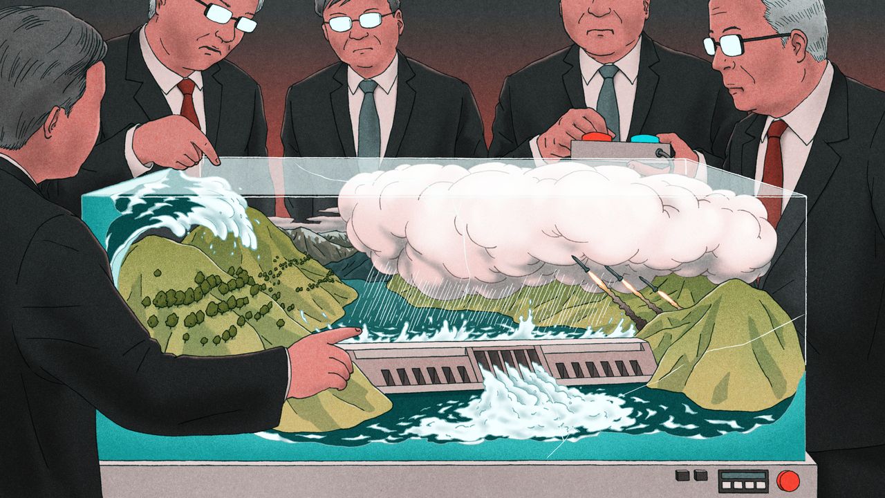
Taming Nature: Inside China's efforts to control the region's waterChina is facing water scarcity that affects millions of people, so the country is embarking on water projects on a scale the planet has never seen. This three-part series investigates three elements of this effort: the world's biggest dam, a doomed effort to create a "river in the sky," and a colossal water transfer project.China controls some of the largest rivers in Asia, experiences heavy rain and has vast stores of water locked in glaciers in the west. But despite these abundant resources, China has a water problem. While central and southern regions are quenched by massive rivers like the Yangtze, the northeastern megacities like Beijing and Tianjin have endured serious water scarcity as agriculture, industry and population size rapidly increased. To address the imbalance, China has undertaken one of the biggest engineering projects in the world: rerouting the flow of one of the world's mightiest rivers and its tributary, and ferrying the water thousands of miles from the center and south of the country to the thirsty north. Called the South-to-North Water Transfer Project (SNWTP), the vast system of canals, pipes, dams, reservoirs and pumps moves staggering amounts of water via two routes through central and eastern China.The Hongze Station on the eastern route of the South-North Water Transfer Project in Huai 'an City, China. (Image credit: CFOTO via Getty Images)"It binds into a single network four major river basins, six provinces, three megacities, myriad bureaucracies, and more than 700 million people," Michael Webber, a professor emeritus in the School of Geography, Earth and Atmospheric Sciences at the University of Melbourne who specializes in regional economic development in China, wrote in a 2023 journal article.But even this is not enough to satisfy the water needs in the North: China is currently expanding these routes and is planning a third, western route for the project, which would snake through the Tibetan Plateau before feeding the water-parched north and east. The route is attractive to Chinese officials because the river-and-glacier-threaded plateau, dubbed the Water Tower of Asia, has abundant water resources and is the source of numerous major rivers.However, experts say the routes could worsen conditions in parts farther south that provide the water. What's more, the Tibetan portion of the project has stoked fears and suspicion in neighbors, as unofficial plans swirl suggesting major transboundary rivers could be diverted away from other countries and further into China. The huge plan is "unbelievable," Mark Wang, a professor of human geography at the University of Melbourne, told Live Science. "The proposals [have] underestimated the negative impacts environmental, earthquakes, evaporation and economic cost," as well as the international impacts, Wang added.Water imbalanceConstruction of the SNWTP began in 2002. The eastern route has operated since 2013 and transports water from the mighty Yangtze from Yangzhou, near Shanghai, to the megacity Tianjin, which has a population of 15 million people. The central route, which goes from Danjiangkou to Beijing and Tianjin, began flowing the following year, carrying water from the Han River, or Hanjiang. Together, they have moved 21 cubic miles (88 cubic kilometers) of water more than 1,800 miles (2,900 kilometers) since they began operating, according to the Chinese government more than double the maximum amount of water held in Lake Mead.The Danjiangkou reservoir was expanded to supply the Central route, which flows to Beijing. (Image credit: silkwayrain via Getty Images)The motivation for this project is obvious: China must support nearly 20% of the world's population with just 6% of its freshwater reserves. And this water is not distributed evenly across the country. Northern China has nearly half of the country's population and more than half of its agriculture but just one-fifth of the country's freshwater reserves. In some places, the imbalance is even more dramatic. Tibet, in the west, has 4.8 million cubic feet (136,800 cubic meters) of water per person, while Tianjin, in the Northeast, has just 3,990 cubic feet (113 cubic m) per person. The United Nations considers less than 1,000 cubic m (35,000 cubic feet) of fresh water available per person water scarcity and less than 500 cubic meters (18,000 cubic feet) per person as "absolute water scarcity." The average in the U.S. is 314,300 cubic feet (8,900 cubic m).Water transferChina has a long history of rerouting water to serve its needs. Parts of the eastern route, for instance, use the Grand Canal, which was first built in the fifth century B.C. And the broad concept of transferring water from the south to the north was first laid out by Mao Zedong, China's first communist leader, in 1952. "Control of water has been a key theme in Chinese history and mythology," Tom Harper, a lecturer at the University of East London specializing in Chinese foreign policy and international relations, told Live Science. Map showing the two completed routes and the official plan for the western route. (Image credit: Zhang et al. (2022): CC BY 4.0)Currently, the eastern route, which stretches 715 miles (1,150 km) from the Yangtze River to eventually reach Tianjin, transfers around 4 cubic miles (15 cubic km) of water per year.This water needs to travel 213 feet (65 m) uphill, meaning pumping stations have to raise the water along the route. The central route, meanwhile, relies on gravity to channel around 3 cubic miles (13 cubic km) of water 790 miles (1,270 km) from Danjiangkou Reservoir, on the Han River in Hubei province, to eventually reach Tianjin. The Danjiangkou Reservoir already existed before the commencement of the project, but it was significantly expanded to raise the water level and required 350,000 people to be relocated as a result.The routes are now key to providing water to Beijing and Tianjin. For example, around 70% of Beijing's water comes from the route, experts told Live Science.Fixing the fixesThe Chinese government and many Chinese scientists have boasted that the project has increased the water supply to people in northern China, raised the groundwater table in northern regions, and increased economic activity and agriculture in the region. A major part of the project also focused on improving water quality: Freshwater supplies in China are heavily polluted, which reduces the amount of drinkable water. "These were reservoirs, these were rivers, these were groundwater resources that had severe pollution impacts," Darrin Magee, a dam expert at Western Washington University, told Live Science. "So in the south where we had abundant water resources, the quality tended to be very bad in some areas." To rectify this, the SNWTP installed water-cleaning stations along the route and the government implemented measures to reduce water pollution, including shutting down or relocating hundreds of manufacturing businesses that dumped their waste into waterways along the routes. Along the eastern route, "pollution was terrible," Wang noted. "The central government put in a lot of effort and they have control of the pollution again in a short period of time," he noted, adding that the water quality has significantly improved along the routes.However, experts have said that the massive project has damaged ecosystems, displaced hundreds of thousands of people and fueled saltwater intrusion into underground reserves in water-providing areas, as the Yangtze River's freshwater flow is reduced. "When the South-North Water Transfer was being proposed, many, many Chinese scientists were also against it because you just create lots and lots of new problems, whatever you fix," Emily Yeh, a professor of geography at the University of Colorado Boulder who specializes in Tibet, told Live Science. "Why not conserve water instead?" Other experts agreed. "The water problem in China, it's not just physical water scarcity, it's the structural problem," Wang said. The biggest driver of water consumption is farming irrigation, which is water-intensive and leads to significant water loss. Conserving that water would go a long way to alleviating water scarcity, Wang added.If China's "first priority is conservation, you won't need a large-scale, world's largest mega project," Wang said. Chinese authorities seem to be realizing this. They're also attempting large-scale water conservation policies, Wang said. But the country is forging ahead with engineering projects.The SNWTP's sources, particularly along the Han River, have less water per capita than the world's average, so siphoning off large amounts of the river's water could severely strain local areas. This has become such a problem that Chinese authorities are now undertaking even more engineering projects to alleviate the problem caused by the SNWTP. For instance, a new, smaller diversion is being added near the Danjiangkou reservoir, because people downstream are not getting sufficient water, Wang said.The central route is further being extended to improve Danjiangkou's water levels. The central route relies on gravity, so a high water level is required for the route and the reservoir's dam to function. If water levels dip too low, as happened in 2011 during droughts, the dam stops working. So, engineers are connecting the Danjiangkou reservoir to the Three Gorges Dam, the world's largest dam, on the Yangtze, to increase the water supply.The project is "a fix to fix the fix to fix the fix," environmental researcher Stevan Harrell wrote in the Made in China Journal emphasizing the ever-growing number of engineering projects to deal with poor water governance.Western routeEven though the two existing routes provide vast amounts of water to the North, and other water-conservation measures are being rolled out, Chinese authorities say the supply to the North is still not enough to meet demand, and that more water diversion is necessary. The SNWTP's planned western route through the Tibetan Plateau won't start operations until at least 2050, but since its earliest planning stages, it has been mired in controversy.The western route's official path would take 4 cubic miles (17 cubic km) of water per year from the Tongtian, Yalong and Dadu rivers all tributaries that eventually feed into the Yangtze. The route would cross about 190 miles (300 km) of the Tibetan Plateau to the Yellow River, which then flows to the water-scarce north and east. The government has commissioned more feasibility studies for this route as part of the country's newly announced five-year plan.The Tibetan Plateau's high, rugged and earthquake-prone landscape creates numerous challenges to potential infrastructure projects (Image credit: primeimages via Getty Images)The construction of such a massive project is fraught with difficulty. The Tibetan Plateau rises 10,000 to 15,000 feet (3,000 to 4,500 m) above sea level. These high altitudes present several problems, such as challenges in construction and maintenance, and difficulties in preventing water from freezing. To transfer water across the plateau, the route would require pumping stations, along with a series of 300- to 1,000-foot-tall (100 to 300 m) dams, which would rank among the tallest dams in the world. The project would also require cutting 200 miles (300 km) of tunnels through the mountains, including the Bayan Har Mountains, which separate the upper Yangtze and Yellow River drainage basins.The Tibetan Plateau is very seismically active, meaning earthquakes could lead to collapses or landslides, potentially damaging the vast infrastructure. In 2018, Chinese scientists attempted to overcome the difficult terrain by transferring water through the air. But the "Sky River," or Tianhe project, ultimately proved unfeasible and has been effectively cancelled.But China has not been deterred by these obstacles. The ongoing construction of the Dianzhong Water Diversion Project, in Yunnan province in southwest China, provides a test case for transferring water across mountainous, earthquake-prone landscapes. The damless design relies on a 380-mile-long (610 km) series of 58 tunnels, as well as pumps, to carry water through the mountainous and seismically active terrain. It is the "the world's longest water tunnel that could fit two high speed trains" and is "seen as a pilot demonstration project that will inspire and inform the design for the Western Routes," according to the Hong Kong-based think tank CWR. The first stage of the Dianzhong project is due for completion later this year, with a second phase recently announced.Red flagWhile the official western route has yet to break ground, alternative proposals have caused serious concern in neighboring countries. One unofficial plan developed in the 1990s, which politicians and academics subsequently considered completely unworkable, suggested funneling 48 cubic miles (200 cubic km) of water (four times the flow of the Yellow River) away from the Brahmaputra River, which flows into India and Bangladesh, and diverting the water toward the Yellow River basin, which serves the North and East of China.A second controversial proposal, known as the Red Flag River project, suggests diverting 14 cubic miles (60 cubic km) of water 3,700 miles (6,000 km) from the Lancang, Nu and Yarlung Tsangpo rivers (called the Mekong, Salween and Brahmaputra rivers when they leave China) across the Tibetan Plateau to the northern Xinjiang region, which has high water stress and is facing desertification. Officials suggested the plan could turn Xinjiang into China's "California." The diverted water could also potentially be rerouted toward Beijing, experts told Live Science. Some experts have called these "semi-official" proposals, as they have no official government backing but have been discussed openly by researchers with heavy government backing and support in China, which the government wouldn't allow if these people were truly speaking out of turn, Wang said.Science Spotlight(Image credit: Marilyn Perkins / Future)Science Spotlight takes a deeper look at emerging science and gives you, our readers, the perspective you need on these advances. Our stories highlight trends in different fields, how new research is changing old ideas, and how the picture of the world we live in is being transformed thanks to science.Despite no official government backing, the plans have worried neighboring countries, particularly India, due to fears that any water diversions on international rivers could significantly reduce vital downstream supplies. Massive water engineering projects are already being built in Tibet, such as the upcoming Motuo megadam on the Yarlung Tsangpo close to the proposed starting point for the Red Flag River project. "There's a lot of concern that there might be water diversion, because China has been talking about this for many, many years," Tenzin Norgay, a researcher at the nonprofit organization International Campaign for Tibet, told Live Science. "If it happens, it's going to be a huge risk to downstream countries."Researchers have calculated that the Red Flag project would likely siphon around 20% of the rivers' upstream flows, though the overall water loss for the whole of each river is less than that. Regardless of the actual amount of diversion, the lack of international consultations and transparency is exacerbating suspicions, experts told Live Science.A changing climateWhile China is forging ahead with attempts to redistribute China's water and reduce water scarcity via the SNWTP, climate change could scramble those plans. An increased risk of droughts over the coming decades could compromise the SNWTP's ability to move water.The Tibetan Plateau, which is a source of water for almost 2 billion people, is particularly at risk. The world's "Third Pole" is rapidly warming, leading its numerous glaciers to melt. This could lead to sudden flooding, followed decades later by reduced river flow as the glaciers disappear. Desertification, meanwhile, is also impacting the Tibetan Plateau. "Short to medium term, [we'll] see an increase in runoff as melting begins earlier each year," Magee said. "But over the long term, decreased snowpack means less secure water resources for most of China." Taming natureThe government is really imagining Tibet as a source of ecological service for the rest of the countryEmily Yeh, professor of geography at the University of Colorado BoulderChina's water management approaches include vast dam-building projects, cloud seeding, monumental tree-planting schemes and water-transfer projects, all of which rely on technological and engineering solutions to control the natural world, experts told Live Science.When it comes to megaprojects, "If there's any country that will do it, it's China," Magee said. "The People's Republic of Engineers." Other experts agreed. "It is part of this idea that you can engineer your way out of these problems, even if it's with trees rather than with machines," Yeh said. "A large-scale engineering approach to the natural world has been a characteristic of Chinese approaches to perceived or real environmental problems."This is particularly true for the Tibetan Plateau. "The government is really imagining Tibet as a source of ecological service for the rest of the country," Yeh said.Related storiesDams around the world hold so much water they've shifted Earth's poles, new research showsChina installs world's largest floating wind turbine in deep water test it generates enough energy to power 4,200 homes annuallyChina has planted so many trees around the Taklamakan Desert that it's turned this 'biological void' into a carbon sink Other experts agreed that Chinese authorities typically take an engineering approach to attempt to manage nature.But Wang noted that China faces big pressures, which is why its government is looking for big solutions."If you understand China's energy issues, you understand why China is doing this. If you understand the water and food security issues, you understand so many things China has done," Wang said.
0 Commentaires
0 Parts
41 Vue