

The maps ancient Greeks drew of their world were riddled with errors — continents warped out of shape, seas stretched to impossible lengths, and the entire known world centered, conveniently, on Greece itself. Yet these same flawed documents gave birth to scientific geography, influenced the thinking of Columbus, and carried hard-won knowledge across two millennia. Here are ten facts that reveal why the history of ancient Greek maps is far stranger, and far more consequential, than most accounts let on.
1. Homer’s Ocean River: The Oldest Greek World-Map Was a Poem

Around 900 B.C., long before anyone pressed stylus to clay to sketch a coastline, Homer described the entire inhabited world as a flat disk encircled by a single great river called Oceanus. Early Greek cartographers took this poetic vision seriously and rendered it exactly that way — a circular landmass with an endless stream of water forming its rim. This was not simple geographical ignorance; it reflected cosmological conviction. The river-ocean boundary gave the known world a mythologically satisfying edge, a threshold where the human and the divine quietly met.
The influence of that image proved astonishing in its staying power. Greek views of the world continued to echo Homeric structure for centuries after his death, and scholars of ancient cartography routinely trace the circular map tradition directly back to his verses. Homer never drew a single line on papyrus, yet he is, in effect, the godfather of the entire enterprise.
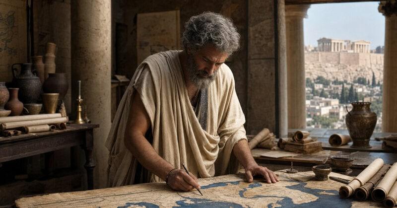
2. Anaximander of Miletus and the First Known Drawn World Map, c. 550 B.C.

Sometime around 550 B.C., the philosopher Anaximander of Miletus made a leap that still impresses modern historians of science: he translated the world from words into a drawing. His was the earliest known attempt at a visual map of the entire inhabited earth — a foundational act in the history of Greek geography. The earth he depicted was a flat cylinder surrounded by ocean, with the known world divided into two roughly equal halves: Europe to the north and a broad southern zone that grouped together both Asia and Africa.
No original survives. Every reconstruction scholars have produced is, by necessity, a detective puzzle assembled from later descriptions and passing references, which means the first drawn world map exists today only as an educated inference. That uncertainty makes Anaximander’s achievement simultaneously foundational and tantalisingly out of reach — a ghost map haunting the entire history of ancient Greek cartography.
3. Hecataeus Revised the World Map and Wrote a Geographic Encyclopedia to Accompany It

Around 500 B.C., Hecataeus of Miletus took Anaximander’s pioneering map and gave it a thorough, empirically minded overhaul. He paired his revised map with a prose work called the Periegesis — meaning “Tour of the Earth” — creating what amounts to antiquity’s first illustrated geographic encyclopedia. Where his predecessors had leaned heavily on myth and poetic tradition, Hecataeus gathered accounts from merchants, sailors, and travelers, treating geography as a discipline to be actively investigated rather than passively inherited.
His map still retained the circular ocean-encircled outline that Homer had popularized, but within that familiar frame it named and placed far more peoples and territories than any predecessor had attempted. The combination of visual map and explanatory text was itself a conceptual breakthrough. The idea that a picture and a prose description could work together to explain the shape of the world would echo forward through every atlas ever produced.
4. Herodotus Mocked the Circular Map Tradition — Then Struggled to Replace It

Writing around 450 B.C., the historian Herodotus turned his sharp wit on the cartographic conventions of his day and found them wanting. He publicly ridiculed the perfectly circular world maps that had dominated Greek thinking since Homer, arguing there was no empirical reason to assume the earth was trimmed into a neat disk with an ocean border. It was, he suggested, a tidy idea that revealed more about the Greeks’ fondness for geometric symmetry than about the actual shape of the continents.
The critique is historically significant — it marks the first clearly recorded moment of self-aware skepticism within the long tradition of maps of ancient Greece. The uncomfortable irony, however, is that Herodotus offered no geometrically superior alternative. His own geographic descriptions contain substantial distortions of Africa, Asia, and the Black Sea region, demonstrating that demolishing a flawed model is considerably easier than constructing a better one.
5. Pythagoras and Aristotle Argued the Earth Was a Sphere — Overturning Every Flat Map Ever Drawn

By the 6th century B.C., Pythagoras had proposed, on philosophical and aesthetic grounds, that the earth must be a sphere — a perfect shape befitting a perfectly ordered cosmos. Aristotle, writing two centuries later, moved the argument from philosophy to observable evidence: he noted that during lunar eclipses the shadow the earth casts on the moon is always circular, regardless of the angle of projection, which is consistent only with a spherical object. It was one of antiquity’s finest moments of empirical reasoning.
The implications for ancient Greek cartography were profound. A spherical earth meant that every flat disk map ever drawn was not merely imprecise in its details but misconceived in its fundamental structure. Greek cartographers could no longer simply fill in blank spaces on a circular outline; they had to rethink the underlying framework entirely. This intellectual shift laid the essential groundwork for the grid-based mapping system built on lines of latitude and longitude that Eratosthenes and later Ptolemy would develop — and that remains in use today.
6. Eratosthenes Calculated Earth’s Circumference to Within Roughly 2% Accuracy and Built a Map Around It

Around 240 B.C., Eratosthenes, the chief librarian of Alexandria, performed one of the most elegant experiments in the history of science. He learned that at noon on the summer solstice the sun shone directly down a well at Syene (modern Aswan), casting no shadow, while at Alexandria on the same day a vertical rod cast a measurable shadow. By measuring that shadow angle — approximately 7.2 degrees, or one-fiftieth of a full circle — and multiplying the known distance between the two cities by fifty, he calculated Earth’s circumference at roughly 39,375 kilometers. The actual figure is approximately 40,075 kilometers, making his margin of error less than two percent. He achieved this with a shadow, a measured road distance, and systematic reasoning, more than two thousand years before satellites.
Eratosthenes then used that calculation as the structural backbone of a world map divided by systematic lines of latitude and longitude, placing the known world in a framework that stretched from the British Isles to India. He is widely regarded as the father of scientific geography, and his work stands as the high-water mark of ancient Greek cartography — a moment when the discipline came extraordinarily close to capturing the true dimensions of the earth.
7. The Mediterranean Was Drawn Nearly 20 Degrees Too Wide on Ancient Greek Maps

For all the brilliance of individual thinkers like Eratosthenes, ancient Greek geography maps carried one stubborn, far-reaching error from generation to generation: the Mediterranean Sea was consistently drawn approximately twenty degrees of longitude longer than it actually is. The distortion crept in early and proved nearly impossible to dislodge, partly because the accumulated weight of mariner lore and commercial records centered on that sea reinforced the inflated figure rather than correcting it.
The consequences rippled forward across nearly two thousand years. The Roman-era cartographer Claudius Ptolemy inherited and codified the error, it persisted through the medieval period, and some historians argue it contributed to Christopher Columbus’s optimistic calculation of how far west he would need to sail before reaching Asia — if the Eurasian landmass was as wide as Greek maps suggested, the Atlantic crossing looked far more manageable than it was. The distortion was not corrected with precision until the 17th century, a striking monument to how long a single embedded measurement error can shape human understanding of the world.
8. Ptolemy’s Geography Codified Greek Cartographic Knowledge Around 150 A.D. — Errors Included

Around 150 A.D., the Alexandrian scholar Claudius Ptolemy produced a work that would define geography for the next fifteen centuries. His Geography, spread across eight books, synthesized the accumulated knowledge of ancient Greek cartography and assigned coordinates — expressed in degrees of latitude and longitude — to approximately 8,000 places across the known world. The coordinate system itself was a conceptual gift of lasting importance; its basic logic underlies the geographic coordinate system still in use today.
But Ptolemy also enshrined the errors his predecessors had bequeathed him: the overstretched Mediterranean, and a vast, entirely imaginary southern continent — Terra Incognita — that sealed off the Indian Ocean and made it appear to be an enclosed sea rather than open water. When his text was lost to Western Europe after the fall of Rome and then rediscovered and translated into Latin in 1406, it arrived with all those ancient mistakes intact. It nonetheless ignited the Renaissance explosion in mapmaking, demonstrating that even a deeply flawed synthesis can catalyze profound intellectual progress.
9. Greek Maps Consistently Placed Greece — Specifically Delphi — at the Center of the World

There is a carved stone at Delphi, rounded and decorated with a net of incised bands, that the ancient Greeks called the omphalos — the navel of the world. The myth behind it was precise: Zeus had released two eagles simultaneously from opposite ends of the earth and watched to see where they would meet. They met at Delphi. That story was not mere local pride; it functioned as cosmological geography, and it shaped the way Greeks drew their maps, placing the Greek mainland at or near the central axis of the inhabited earth.
The cultural motivation is unmistakable, and it transforms ancient Greek geography maps into something richer and stranger than simple navigation aids. They were ideological documents — arguments about where meaning resided in the world. Every civilization that has ever made maps has tended to place itself near the center, but the Greeks were unusually explicit about the theological reasoning behind that choice, and the omphalos stone at Delphi remains one of the most tangible artifacts of that conviction.
10. Strabo’s Geographica Was the Most Comprehensive Greek World Description Ever Written — and Almost Certainly Contained No Maps

Around 20 B.C., the Greek scholar Strabo completed Geographica, a seventeen-volume survey of the known world that stands as one of the most important sources for ancient Greek geographical knowledge. It covered territory stretching from Ireland — which Strabo called “Ierne” and described as a cold, barely habitable island at the world’s edge — all the way to India, with detailed accounts of the peoples, climates, political arrangements, and landscapes of each region along the way.
The remarkable and slightly paradoxical fact about this monumental work is that it almost certainly contained no actual maps. Strabo described everything in prose, trusting the precision of careful language over the precision of drawing to convey where things were and what they looked like. In doing so, he preserved knowledge of places whose maps, if they ever existed, have long since crumbled to dust. His words became, in the end, the most durable cartographic record of the ancient Greek world.
From Homer’s river-circled disk to Ptolemy’s coordinate-laden atlas, the maps of ancient Greece were simultaneously visionary and deeply mistaken — and it is precisely that combination of bold intellectual ambition tangled with persistent human error that makes them among the most revealing documents any civilization has ever produced.